
Qinghai Tibetan Plateau | 23 Oct to 2 Nov 2026
Introduction
Between the Arctic and Antarctica, in the highest region of our planet lies a vast and largely overlooked cryosphere—elevated, remote, and critical to humanity’s survival.
Spanning the Tibetan Plateau and the highlands of Qinghai, it holds the largest reserve of ice outside the polar regions. Often called the Roof of the World and the Water Tower of Asia, this frozen landscape gives rise to the Yangtze, Yellow, and Mekong rivers—arteries that sustain nearly two billion people downstream.
This system is now under accelerating stress.
The Third Pole is warming at more than three times the global average. Glaciers are retreating at measurable rates. Permafrost is degrading beneath grasslands and infrastructure. Rivers once considered stable are becoming increasingly unpredictable. Alpine ecosystems are being reshaped by rising temperatures, changing precipitation, and diminishing snow cover.
Whatever vanishes here does not end here. Everywhere downstream will be affected—agricultural systems, floodplains, deltas, and fisheries across Asia—and ultimately into the Pacific and Indian Oceans.
This expedition is a mission to document one of the most consequential and least understood climate frontiers on Earth—before transformation becomes irreversible.
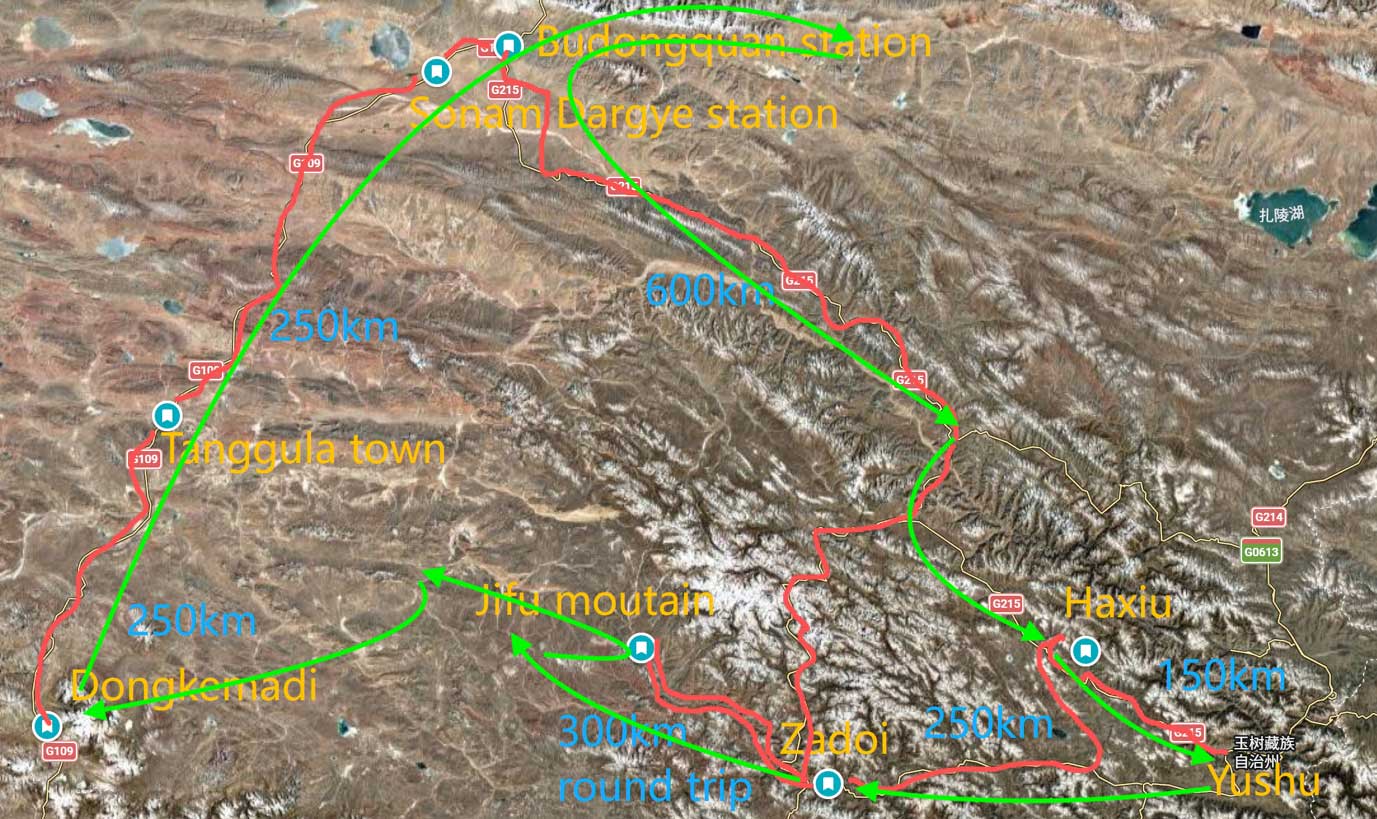
From the wetlands and headwaters of Sanjiangyuan National Park—the Source of Three Rivers—to the high-altitude grasslands of Yushu and the wilderness of Kekexili, this journey traces the hydrological origins of Asia.
This expedition documents the headwaters region of civilisation—from ice to river, which eventually flows into the Pacific Ocean and the South China Sea—to document the systems that sustain megacities, agriculture, fisheries, and over 2 billion people downstream.
The expedition will bear witness to landscapes where glaciers are retreating faster than previously projected, where seasonal patterns are shifting, and where the stability of entire regions may ultimately depend on changes occurring above 5,000 metres.
This expedition is a journey through a connected system:
• Ice forming at altitude
• Ice melting into rivers
• Rivers sustaining ecosystems and societies
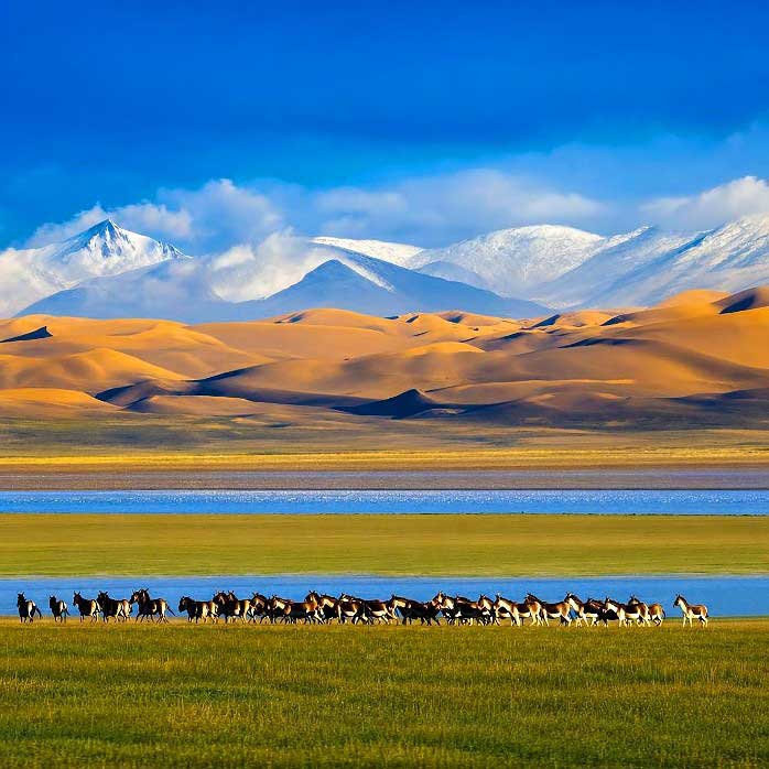
The Third Pole remains one of the last great wildernesses on Earth. Snow leopards move across fractured ridgelines. Tibetan antelopes continue ancient migrations across open plains. Wild yak, kiang, White-lipped deer, Black-necked cranes, wolves, and raptors persist in an environment where oxygen levels are significantly reduced, and conditions remain extreme.
These species are key indicators of ecological stability.
The expedition will also document the human dimension of the plateau.
Tibetan pastoralist communities remain closely tied to land, water, and seasonal cycles. Their livelihoods depend directly on the health of grasslands, glaciers, and river systems.
Here, climate change is not abstract. It is observed through:
• shortened winters
• reduced snowfall
• unstable water sources
• shifting pasture conditions
These are early signals of broader systemic change.
Witness Climate Change at the Source
• Glacial retreat and fragmentation
• Permafrost degradation
• Hydrological instability
• Alpine ecosystem shifts
• Climate-driven transformation of river systems
Document the Source of Asia’s Great Rivers
• Yangtze River headwaters
• Yellow River origins
• Mekong River source systems
Create a Visual Record of Endangered Wildlife
• Snow leopard (Panthera uncia)
• Tibetan antelope (Chiru)
• Wild yak
• Kiang (Tibetan wild ass)
• White-lipped deer
• Black-necked crane
• Tibetan wolf and high-altitude raptors
Document Indigenous Ecological Knowledge
• Pastoralist traditions
• Sacred landscape relationships
• Water and river reverence
• Local climate observations
Area of Focus
Sanjiangyuan National Park — Source of Three Rivers
The ecological heart of the Third Pole.
This vast protected landscape contains the headwaters of the Yangtze, Yellow, and Mekong rivers—one of the most important freshwater systems on Earth.
Key features:
• Alpine wetlands
• Braided river systems
• Permafrost landscapes
• Migration corridors
• High-altitude biodiversity
Yushu serves as the expedition’s base and cultural entry point into the plateau.
Focus:
• Tibetan pastoralist life
• Climate impacts on communities
• Monasteries and spiritual landscapes
One of the most important wildlife corridors in the region.
Highlights:
• Tibetan antelope migration routes
• Predator–prey systems
• High-altitude ecosystem dynamics
A remote hydrological frontier where the Mekong begins as meltwater and marsh.
Highlights:
• Early-stage river formation
• Wetland ecosystems
• Climate-sensitive landscapes
Within the Yangtze headwaters lies one of the most critical cryospheric systems on Earth. These glaciers are not vast or easily accessible.
They are remote, fragmented, and rapidly retreating—yet they define the hydrological future of Asia.
Primary Glacier Systems — Yangtze Headwaters
Dongkemadi Glacier 冬克玛底冰川
• One of the most studied glaciers on the Tibetan Plateau
• Long-term measurements of ice thickness and mass balance
• Provides measurable evidence of climate-driven retreat
Jianggendiru Glacier 姜根迪如冰川
• Exhibits clear structural fragmentation
• Ice bodies visibly separating
• Direct visual evidence of glacier disintegration
Mount Geladandong 各拉丹东峰(长江源)- Reference System
• Glaciated massif marking the source of the Yangtze River
• Hydrological and symbolic anchor
• Observed as a distant reference
Secondary Glacier Systems — Eastern Sanjiangyuan
Nangqên Ice Fields 囊谦冰川区
Including Gangqing Dasar Glacier 岗青达萨冰川
• Smaller, fragmented glacier remnants
• Highly climate-sensitive systems
• Represent gradual disappearance rather than dramatic collapse
Interpretation
Together, these glacier systems reveal the full spectrum of cryospheric change:
• Retreat
• Structural fragmentation
• Gradual disappearance
At the source of the Yangtze, ice is not just retreating—it is breaking apart, thinning, and vanishing.
Scientific Context Between 2000 and 2018₁
• Significant. Glacier numbers declined
• Total glacier area shrank significantly
• Ice volume decreased by approximately 18.6 km³
• Average glacier length shortened
• The loss rate of glacier area in the Yellow River source area in 2010–2018 was more than twice that in 2000–2010.
• Yangtze River source area witnessed the largest area loss (−154.45 km2), whereas glaciers in the Mekong River source area experienced the fastest area loss (−2.02%·a−1) and the maximum reduction of the average length.
This loss is accelerating. In less than a decade, the Third Pole has lost enough ice to fill more than seven and a half million Olympic-sized swimming pools—water that could supply roughly half a billion people for a year.
Ref₁: Zhang, Y., Yao, X., Zhou, S. et al. Glacier changes in the Sanjiangyuan Nature Reserve of China during 2000–2018. J. Geogr. Sci. 32, 259–279 (2022). https://doi.org/10.1007/s11442-022-1946-0
Kekexili (Hoh Xil) — The Great Wilderness
One of the last true wildernesses on Earth. A UNESCO World Heritage site, Kekexili remains vast, isolated, and largely untouched.
Known for:
• Tibetan antelope migration
• Wild yak and predator systems
• Extreme altitude and climatic conditions
Kekexili now is life at the edge of endurance.
Vision
The Ocean Geographic Third Pole expedition is about bearing witness. The glaciers of the Third Pole are the origin of systems that sustain Asian civilisation.
Sanjiangyuan Nature Reserve, at the source of these rivers, is at the beginning of the consequences.
When the Third Pole fails, it will affect over two billion people downstream – water, food security, ecosystems, and oceans.
The Third Pole expedition is about connection: From glacier to river. From river to ocean. From the top of our world to the ocean to the future of humanity.
WHEN THE THIRD POLE FAILS, EVERYTHING DOWNSTREAM FAILS.